Lake Erie Imperative to the identity of the City of Erie, Lake Erie, the oldest of the Great Lakes, has been recognized as a vital resource since the days of the first Erie settlers. As part of the largest continuous mass of freshwater on Earth, the value of Lake Erie as a source of fresh drinking water can never be overstated. In addition, Lake Erie has been known as the fresh water fishing capital of the world, the shipping gateway for Americas westward expansion, a resource for Industrial Age manufacturing and a recreational playground. Lake Erie has and always will be a defining feature on the face of Erie. Swimming, fishing, boating and other recreational water activities dominate the lakefront.
|
Geologic Formation Erie County is situated within two physiographic provinces: the Central Lowland (lake plain), which is characterized by low and generally flat appearances, and the Appalachian Plateau, which features higher elevations and rolling characteristics. Between the two provinces is an area known as the escarpment slope.
Eight classes of bedrock compose the geological makeup of Erie County. However, Northeast Shale, Girard Shale, Chadakoin Formation, Venango Formation and Corry Sandstone dominate the county. These five classes of bedrock consist mostly of gray shale, siltstone and fine-grained sandstone. The bedrock in Erie County dates back to the Upper Devonian geologic time period (359-385 million years ago). There are some smaller younger areas in the southern portion of Erie County, near the border of Crawford County, that date to the Lower Mississippian geologic time period (345-359 million years ago). The Northeast Shale is the oldest exposed bedrock in the county and lies in a band along Lake Erie and approaches a thickness of approximately 400 feet. The Girard Shale, which runs parallel to the shore, ranges from 50 to 200 feet in thickness. The Chadakoin Formation is about 300 feet thick, contains some marine fossils, and is the most extensive bedrock in the county. The Venango Formation approaches a thickness of 250 feet and consists of gray sandstone, light-gray siltstone and shale with a bluish-gray color. Corry Sandstone, at 20 feet in thickness, is responsible for the higher elevated land and hills in southeast Erie County.
Although the City of Erie relies on Lake Erie for drinking water, people living in the rural areas rely on groundwater wells. The groundwater yielded from the aquifer of the dominant classes of bedrock in Erie County is generally acceptable at an average yield of 4.5 gallons per minute, with the Chadakoin Formation yielding the highest quality of water.
|
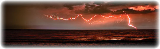 Changing Skies The skies over Erie are always changing. Regional weather effects can create scarlet sunsets, gray mornings or cobalt summer days. Night brings a wide array of stars, constellations, nebulas and galaxies. Erie is far enough north that, on occasion, the Aurora Borealis better known as the Northern Lights can be seen shimmering across the north sky. Astronomy in Erie has a strong following. In 1994, local astronomer Tom Whiting, president of Erie County Mobile Observers, discovered a group of stars he called The Little Coathanger, located south of the last star in the handle of the Little Dipper. Nearly four years later, his discovery was featured in Sky & Telescope Magazine.
|
 Weather Locals use the expression, If you dont like the weather, wait 15 minutes to describe weather in Erie. No doubt, the statement holds true in many instances as area weather conditions change very significantly in short amounts of time. However, one of the generally accepted realities about the sky in Erie is that it is overcast and there is a lot of rain. Such rainy weather has led to Eries nickname Dreary Erie.
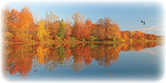
Erie does have the luxury of experiencing four distinct seasons, sometimes referred to as almost winter, winter, still winter and road construction. All jokes aside, the seasonal changes in Erie are truly dramatic. The winter skies are cold, barren and gray, and quite often, arctic winds blow across the lake and ravage the city, driving the temperatures down close to zero. However, the snow does eventually melt and gives way to blooming flowers and the warmer blue skies of spring. Tourists arrive, along with hot temperatures commonly in the 70s and 80s, to enjoy the Erie summers. A kaleidoscope of color marks the landscape as the trees change color and the cool nights of fall arrive.
Eries familiarity with cold arctic-like conditions for nearly half the year makes Erieites a hearty and rugged group of individuals who do not flinch at the thought of freezing temperatures or several feet of snow falling in one day.
|
Record Temperatures in Erie
Highest Recorded Temperature: 100° F in June of 1988
Lowest Recorded Temperature: -18° F in January of 1994
Source: The Weather Channel
|
|
Natural Resources
Sand & Gravel |
| Erie County is home to many sand and gravel pits, which provide much of the material used for construction in the area. One of the more interesting gravel pits in the county is Gravel Pit Park, located on the eastern side of the county within the community of North East. Gravel Pit Park is a reclaimed section of a gravel pit that has been converted into a community park.
|
Timber |
| Erie County has a diverse tree population, and the city streets themselves are lined with many trees. Maple, oak, beech, poplar, hickory, pine and hemlock are all common to this area. Trees provide a valuable resource both naturally and economically, important in construction, furniture making and the production of paper products.
|
Water Authority |
| The City of Erie benefits greatly from its location on Lake Erie, which is a gigantic reservoir of fresh water. Often, other cities in Pennsylvania must impose sprinkling bans and other water use restrictions during the summer due to low water supplies. Erie, however, with such an immense water supply, remains immune to such restrictions.
|
|
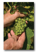 Grapes Grapes
Concord grapes grow most successfully in a few places in the United States one of which is Erie County, just east of the city in a community known as North East. A narrow band of land along the lakeshore, only 3-5 miles wide, has been producing grapes for over 150 years. The Concord grapes in Erie are of such a high quality that the largest Welch Foods, Inc. Concord grape processing plant is located in Erie County, as well as many independent varieties.
|
|
 Land Land
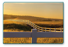
The four low rolling ridges located in Erie County all run parallel to Lake Erie. Between each of the ridges are generally level valley areas. The highest ridge, located 8-10 miles from the lakeshore, forms a watershed divide. A drop of water on the north side of the ridge will flow into Lake Erie and eventually out the St. Lawrence Seaway. A drop of water on the south side of the ridge will flow into the Allegheny River to the Mississippi River, and eventually into the Gulf of Mexico. Except for the low ridges, Erie County is generally flat. The highest point in the county (1,795 feet above sea level) is at the top of a knoll, located in Venango Township, near the border of Greenfield Township and New York State. Except for the intense urban development in and around the City of Erie, the majority of the county consists of forested areas and farmlands. The most extensive soils in the county are part of the Erie Series, a poorly drained and deep upland soil, whose native vegetation consists of ash, maple, pine, cherry and hemlock trees.
|
|
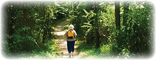 Wintergreen Gorge Pressure and time can do some amazing things. After the last Ice Age, a stream that we know today as Four Mile Creek carved its course north into Lake Erie. With the inevitable passage of time, the waters cut a deep ravine into the highland, wearing away the rock and soft soil as it flowed to the lake, creating a gulch or gorge. The result of all of this activity is a majestic area characterized by rolling contours, wooded glens, quiet pools, waterfalls and a rural cemetery. The area, known today as Wintergreen Gorge, is located in Harborcreek Township. Awe-inspiring scenery makes this area one of the most impressive natural features of the region.
|
Creeks 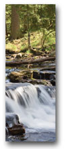 An innumerable amount of creeks, streams and runs weave their way through Erie County. Streams flow both north and south from a watershed divide which runs diagonally across the county, roughly where Interstate 90 is located. Fishing is popular on the Erie County streams, especially those in the Lake Erie Watershed, i.e., those that flow north into Lake Erie. The streams contain a vast array of fish including: steelhead, bass, northern pike, Muskie, walleye, brown trout, catfish and various panfish. An innumerable amount of creeks, streams and runs weave their way through Erie County. Streams flow both north and south from a watershed divide which runs diagonally across the county, roughly where Interstate 90 is located. Fishing is popular on the Erie County streams, especially those in the Lake Erie Watershed, i.e., those that flow north into Lake Erie. The streams contain a vast array of fish including: steelhead, bass, northern pike, Muskie, walleye, brown trout, catfish and various panfish.
The Big Daddy or largest stream of the Lake Erie Watershed is Elk Creek, which is the most popular Lake Erie tributary for fishing. The locally famous American Legion Hole is found on Elk Creek. One of the eeriest geologic formations, a long and very narrow outcropping of rock, called Devils Backbone, is located on Little Elk Creek, south of where Little Elk meets Elk. However, to reach Devils Backbone without traversing privately owned and posted lands, one must hike several miles through the stream itself, which belongs to the Commonwealth of Pennsylvania.
Another one of the large waters in the county is French Creek, although it flows to the south and eventually empties into the Allegheny River. French Creek is a designated Pennsylvania Scenic River and boasts the greatest diversity of organisms within the streams of Pennsylvania.
Walnut Creek is well known in the county for the Project Waters. Due to landowners posting nearly every inch of streamside property in the county and not allowing for public access, recreational opportunities on streams are severely restricted. The Pennsylvania Fish and Boat Commission developed a series of man-made pools called the Project Waters in 1999. The pools were built on Fish and Boat Commission property near the mouth of Walnut Creek for the purpose of providing accessible public fishing opportunities.
Spectators watch an incredible spectacle each fall on Trout Run as the steelhead make their run up the mouth of the creek. The nursery stream, located on the west side of the county, is loaded with steelhead.
Erie Area Creeks and Streams |
- Alder Brook
- Alder Run
- Cascade Creek
- Conneaut Creek
- Crazy Run
- Crooked Creek
- East Branch Conneaut Creek
- Eight Mile Creek
- Elk Creek
- French Creek
- Four Mile Creek
- Godfrey Run
- Middle Branch Conneaut Creek
- Marsh Run
- Mill Creek
- Mud Run
- Raccoon Creek
- Seven Mile Creek
- Six Mile Creek
- Sixteen Mile Creek
- Stone Run
- Temple Run
- Trout Run
- Turkey Creek
- Twelve Mile Creek
- Twenty Mile Creek
- Walnut Creek
- West Branch Conneaut Creek
Source: Pennsylvania Fish and Boat Commission
|
|
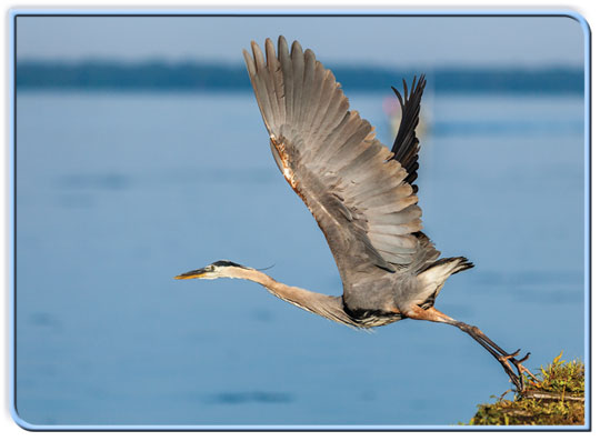
 Presque Isle State Park French explorers named our regions greatest natural wonder and most profound artistic inspiration Presque Isle, or almost an island. Years of sand and sediment accumulation on top of a glacial moraine created a peninsula, which created the best natural harbor on Lake Erie as a result. Presque Isle has no bedrock foundation and is anything but static. The peninsula is in a constant state of flux, continually eroding and reforming, and growing as new sediment deposits on the existing land.
The peninsula has always been a defining mark on the face of the community. Designated as a state park in 1921, Presque Isle is a popular relaxation and recreation spot that draws over 4 million visitors a year. Both tourists and Erieites frequent the Presque Isle peninsula throughout the year and are attracted by spectacular sunsets, unique birding opportunities and, most often, a day at the beach. Presque Isle is the backbone of the tourism industry of Erie and continues to be a major focus of the regions economic development.
|
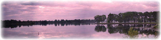
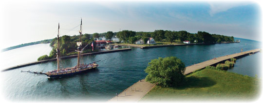 Harbor Channel Presque Isle State Park, a seven-mile sand spit peninsula, projects into Lake Erie and creates Presque Isle Bay. The channel and federally designated harbor areas are maintained by the Army Corps of Engineers. Presque Isle Bay, arguably the best harbor on Lake Erie, has lots to offer; pleasure boating, sport fishing, jet skiing and water skiing are among some of the favorites.
|
|
|